The challenge.
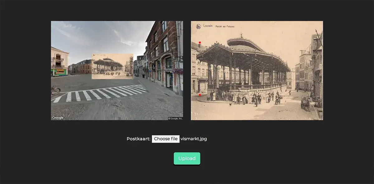
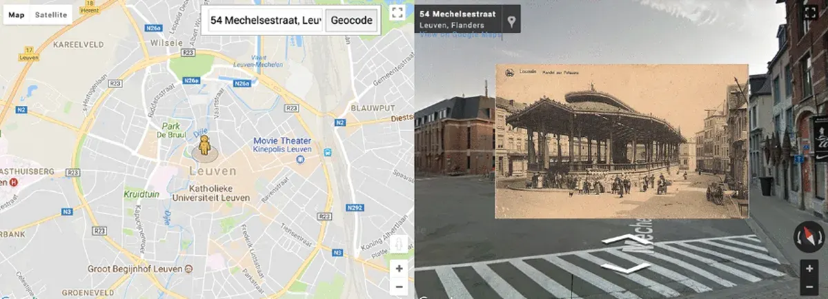
Historical photos needed metadata, coordinates and alignment with present-day views. Positioning was manual, and an AR experience needed validation in real-world conditions.
The key decision.
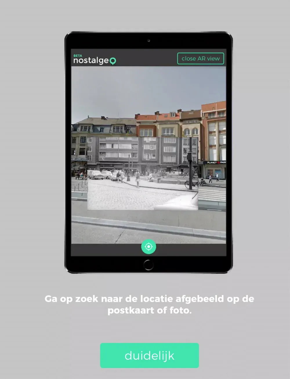
The AR MVP focused on Leuven’s city centre as a bounded testing area. Historical photos appeared as 2D billboards positioned in the mobile camera view, allowing users to approach and view them from different angles.
The rejected option & why.
Manual photo positioning remained a limitation of the existing platform. The project explored how to simplify and automate alignment with Google Street View, without assuming that automation was already solved.
The outcome.
The work developed the concept and interface for exploring historical scenes through AR and investigating simpler image mapping, with a Leuven-focused MVP for real-world evaluation.
The final verdict.
A limited testing area made the AR concept practical to evaluate. The project brought historical imagery and present-day locations together while keeping photo alignment an explicit development challenge.